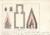
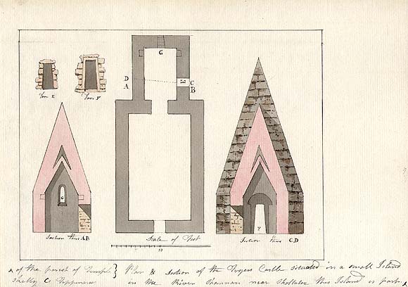
Plan & section of the Fryer's Castle situated in a small Island in the River Shannon near [Skolaloe?]. This island is part of the parish of Templeskelly Co. Tipperary
[graphic].
Plan of Fryer's Castle, County Tipperary, Ireland, showing sections and scale of feet.
Saved in:
Show/hide more info.
| Format: | Prints & Drawings |
|---|---|
| Language: | English |
| Subjects: | |
| Notes: | Title inscribed i nink l.c. on sheet. Watermark visible l.r.: [J Whatman?]. Physical description: 1 drawing : watercolours ; image 13.3 x 17.9 cm., on sheet 17.3 x 24 cm.. Citations/References: Irish Topographical Prints & Drawings / Rosalind M. Elmes. - Malton Press, Dublin, 1975, P. 134. more |
| Published / Created: |
[between ca. 1790 and 1800?].
|
| Online Access: | View image |
Loading...
View the full Record in a new tab
| In Collection: | Grose Collection (PD 1976 TX) [graphic]. |
|---|---|
| Description: | Plan of Fryer's Castle, County Tipperary, Ireland, showing sections and scale of feet. |
| Created: |
[between ca. 1790 and 1800?].
|
| Language: | English |
| Extent: | 1 drawing : watercolours ; image 13.3 x 17.9 cm., on sheet 17.3 x 24 cm.. |
| Format: | Prints & Drawings |
| Call Number: |
PD 1976 TX 43
(Collection unavailable) |
| Rights: | Reproduction rights owned by National Library of Ireland. |